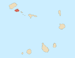
Ribeira de Julião
Appearance
| Ribeira de Julião | |
|---|---|
 | |
| Location | |
| Country | Cape Verde |
| Physical characteristics | |
| Source | |
| • location | São Vicente |
| Mouth | |
• location | Porto Grande Bay |
• coordinates | 16°52′37″N 24°59′53″W / 16.877°N 24.998°W |
Ribeira de Julião is a seasonal stream in the central part of the island of São Vicente in Cape Verde.[1] Its source is in the hills southeast of the island capital Mindelo, and it empties into the Porto Grande Bay, a bay of the Atlantic Ocean, southwest of Mindelo. The village Ribeira Julião and the Mindelo neighbourhood Ribeira de Julião take their name from this stream.
See also
[edit]References
[edit]- ^ Inventário dos recursos turísticos do município de S. Vicente, Direcção Geral do Turismo, p. 27

